
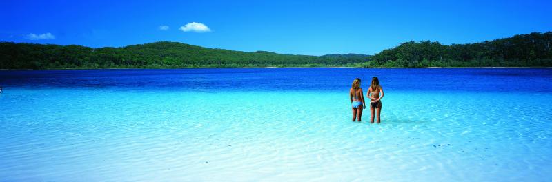
Kigari Fraser Island Travel Guide
Introduction
Fraser Island, known by its traditional Butchulla name Kigari, meaning “paradise,” is the largest sand island in the world, stretching 123 kilometres in length and 22 kilometres across. Located off the coast of Queensland, just north of Hervey Bay, this UNESCO World Heritage site covers an area of 1,840 square kilometres and attracts between 350,000 and 500,000 visitors each year. The island is protected as part of the Great Sandy National Park and is one of Queensland’s most popular natural destinations.
How to Get There
The island is accessible by ferry from River Heads, south of Hervey Bay, to Kingfisher Bay or Wanggoolba Creek, a crossing of approximately 50 minutes. Alternatively, you can take a barge from Inskip Point, north of Rainbow Beach, to Hook Point on the island’s southern tip. A four-wheel drive is required for all landings except at Kingfisher Bay Resort, and you will need a vehicle permit, obtainable online from the Queensland Department of Environment and Science or from several outlets at Rainbow Beach. Several firms provide four-wheel drive hire. Tour buses and self-drive tours depart regularly from Hervey Bay, Rainbow Beach, and Noosa. For a more scenic arrival, chartered flights from Sunshine Coast Airport land directly on Seventy-Five Mile Beach, which is officially designated as a main road and used as a landing strip.
Vehicle permits cost approximately $55 per vehicle for up to one month and must be displayed on the windscreen. Camping permits are separate and range from $7 to $30 per person per night depending on the campground and season. All permits can be booked through the Queensland Parks website. The drive from Brisbane takes roughly four hours to reach the ferry terminals, making it a manageable weekend road trip destination.
Top Things to Do
Lake McKenzie, known as Boorangoora, is the crown jewel of Kigari. This perched lake sits 100 metres above sea level on compact sand and vegetable matter and contains nearly pure silica sand. The water is so clean and soft that swimming here feels like floating in a natural spa. Lake McKenzie covers 150 hectares and is just over five metres deep, with water that has existed in some of these lake systems for over 35,000 years.
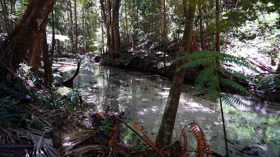
The Maheno shipwreck is one of the most photographed spots on the island. This trans-Tasman ocean liner was washed ashore during a 1935 cyclone, and its rusting hull now rests on the beach as an iconic landmark. Eli Creek is the largest freshwater creek on the east coast, with an impressive flow of 80 million litres per day. Visitors can float downstream on inflatable tubes, carried by the gentle current.
At Indian Head, a rocky outcrop at the northern tip, you can look out over the Coral Sea and spot sharks, rays, dolphins, and sea turtles swimming below the cliffs. Champagne Pools are natural rock pools where ocean waves crash over volcanic rocks, creating safe saltwater swimming away from the stronger surf. The 120-kilometre Seventy-Five Mile Beach runs along most of the east coast and is itself a destination, with coloured sand cliffs at The Cathedrals, The Pinnacles, and Rainbow Gorge.
The Kigari World Heritage Discovery Centre opened on 1 March 2021 and provides excellent interpretation of the island’s natural and cultural history. Central Station, formerly the hub of the logging industry, is another popular stop with interpretive walks through the rainforest. The island’s Butchulla people have lived on Kigari for at least 5,000 years, and the island contains significant cultural sites including shell middens, burial sites, and artefact scatters that provide insight into their traditional way of life.
Wildlife and Dingoes
Kigari is home to an estimated 180 to 220 dingoes, which are among the last pure strains of the species in eastern Australia that have not cross-bred with domestic dogs. To preserve this status, domestic dogs are not permitted on the island. Dingoes are wild animals and should never be fed or approached. There are significant fines for feeding dingoes or leaving food and rubbish accessible. Dingo-proof fences were built around nine island settlements in 2008 to keep the animals out of townships. Visitors should always stay within fenced areas at campgrounds and settlements and follow ranger advice.
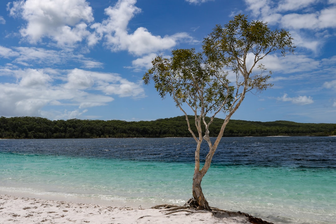
Beyond dingoes, the island supports 25 to 50 mammal species including swamp wallabies, echidnas, possums, sugar gliders, bandicoots, and flying foxes. Over 350 bird species have been recorded, including sea eagles, peregrine falcons, ospreys, pelicans, kingfishers, and brolgas. During winter, humpback whales pass close to the island on their annual migration, and sea turtles and dugongs inhabit the surrounding waters.
Lakes and Natural Features
Kigari has more than 100 freshwater lakes, the second highest concentration in Australia after Tasmania, and some of the cleanest freshwater lakes in the world. Of these, 40 are perched lakes, representing half of all known lakes of this type on the planet. Lake Boomanjin, at 200 hectares, is the largest perched lake on any sea island in the world. Its water is tinted red by tannins collected from the surrounding wallum swamp. Lake Wabby is the deepest lake on the island at 12 metres and contains the most aquatic life due to its lower acidity. Motor boats and jet skis are banned from all lakes on the island to preserve their pristine condition.
The island’s sand dunes have been accumulating for approximately 750,000 years, carried northward by longshore drift from river catchments in New South Wales. The sand is 98 percent quartz, and the dunes grow to heights of 244 metres, moving one to two metres per year driven by year-round southeast winds. The island also contains rare perched bogs and coastal heathlands that provide habitat for several rare and threatened plant species.
Camping and Accommodation
There are numerous campgrounds across the island with varying amenities, including Dundubara Campground, Cathedrals on Fraser, Waddy Point campground, Central Station Tent Sites, and One Tree Rocks camp zone. All require permits for both camping and vehicle access. The 90-kilometre Kigari Great Walk is the most notable hiking route, running the length of the island through rainforest, sandblows, and coastal heath. Shorter hikes are also available, such as the walk from Kingfisher Bay to Lake McKenzie.
For those who prefer roofs over tents, Kingfisher Bay Resort offers hotel rooms, villas, and a restaurant with beautiful views of the Great Sandy Strait. Eurong Beach Resort is another option located on the eastern beach, providing basic accommodation and a general store. Neither is luxurious, but both offer a comfortable base for exploring the island without the need to bring camping gear. Book well in advance during the peak dry season months of June through August when visitors flock to the island.
Best Time to Visit
Kigari has a tropical climate with warm temperatures year round. The best time to visit is from May to October when temperatures are pleasant and rainfall is lower. Sea temperatures range from 22 degrees Celsius between July and September to 27 degrees Celsius between January and March. The summer months from December to March bring higher rainfall and occasional cyclone activity. Temperatures rarely rise above 33 degrees Celsius or drop below 7 degrees Celsius.
If you plan to drive on the beach, check the tide times daily at ranger stations. The beach is only drivable at low tide, and getting caught by the incoming tide can be dangerous. Always carry recovery gear including a snatch strap, shovel, and tyre deflator, and travel with at least two vehicles if possible. The island’s sand driving conditions are challenging for first-timers, so consider joining a guided tour if you are not confident behind the wheel on soft sand.
Travellers building a Queensland nature route can connect K’gari with Brisbane travel guide, Gold Coast travel guide, and Cairns travel guide.

Author: Susan
G'day mates! I'm Susan, a feisty Aussie writer with a love for all things quirky and unconventional. When I'm not pounding away at my keyboard, you can find me binge-watching 'The Bold and the Beautiful' (don't judge me), or trying to teach my pet koala how to do the cha-cha. My writing style can best be described as a mix of sass and wit, with a dash of down-under charm. So if you're in the mood for a good time and a good yarn, give my work a read!